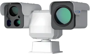
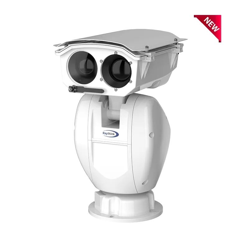
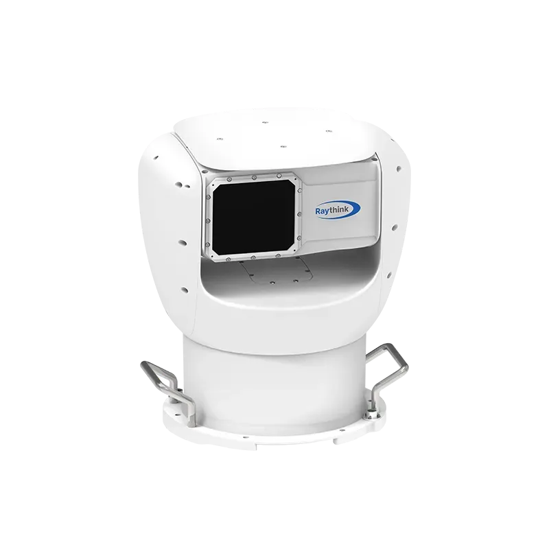
Raythink PC5 Series multi-spectral PTZ camera is tailor-made for medium and long-distance monitoring scenarios such as forest fire prevention and critical-area perimeter security. It integrates a dual-spectral imaging system combining thermal imaging (1280×1024 & 640×512) and visible light (2688×1520), with optional laser rangefinder and laser fill light. Equipped with a high-computing-power SoC, it enables intelligent target recognition of humans, vehicles, vessels, etc., as well as fire point positioning and other functions. Combined with multiple patrol modes, it delivers 24/7 all-weather security monitoring.
1. Core Product Configuration
1) Thermal Imaging
Featuring multi-spectral thermal imaging, it supports 1280×1024 and 640×512 resolution infrared detectors, paired with large-aperture thermal imaging lenses and DLC coating, ensuring durability, reliability, and stable image quality in outdoor environments.
PC5 (640×512 resolution) vs. competitor products (400×300 resolution)
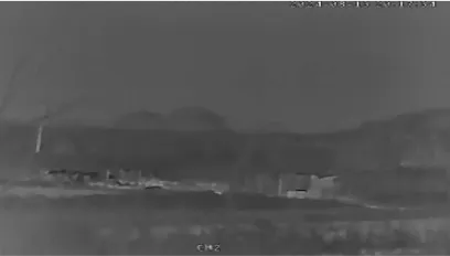
The PC5 Series supports Electronic Image Stabilization, providing better image quality in strong wind conditions.
Before EIS vs. After EIS
2) Visible Light
The visible light module supports 4MP high-definition image quality, paired with telephoto lenses of 6~336mm (56x) or 10~550mm (55x), enabling clear long-distance identification.

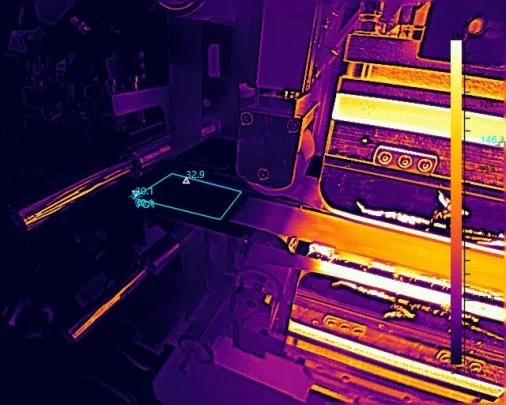
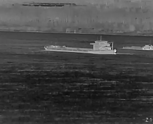
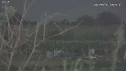
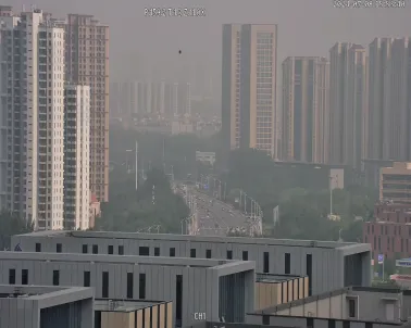
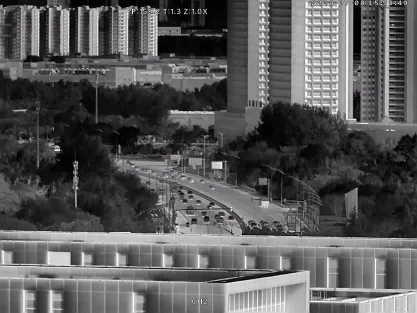
3) Black Light Imaging
The PC5 Series comes standard with a 1/1.25-inch large-target visible light sensor (compared to the industry standard of 1/1.8-inch or smaller), enabling ultra-low-light black light imaging with illumination as low as 0.0005 lx. (1/1.8-inch sensors do not support this function). Comparison with non-black light imaging is shown below:
Black light effect vs. Non-black light visible image vs. Thermal image of the same area
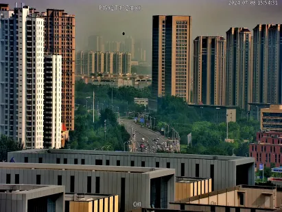
4) AI-ISP Function
The PC5 Series adopts an all-new hardware architecture, integrating a built-in AI-ISP chip to enable AI-based noise reduction, fog penetration, electronic image stabilization, and heat wave removal, significantly optimizing visible light image quality.
Image comparison after applying the fog-penetration algorithm is shown below:
Before fog penetration vs. After fog penetration vs. Thermal imaging
5) Flexible Optical Configuration
Thermal imaging lenses offer multiple focal length options, including 75mm, 100mm, 150mm, and 30~150mm. Among them, the 150mm lens enables fire point detection at distances of up to 10km, meeting diverse monitoring range requirements. Optional 2km / 3km / 6km laser rangefinder modules and 800m / 1500m laser fill lights ensure accurate target acquisition even at night or in complex lighting conditions.
2. Core Competitive Advantages
Through deep integration of hardware and software, the PC5 Series establishes distinct competitive advantages in detection capability, intelligent analytics, and positioning accuracy, precisely meeting the requirements of professional security applications:
1) Long-Distance Precise Detection
Leveraging a 12μm high-sensitivity infrared detector, the PC5 Series can rapidly capture weak heat sources at long distances, with fire point detection possible with only 1.5 pixels. Combined with the 150mm telephoto lens, it can accurately identify fires within a 10km range.

2) AI Intelligent Analysis
Powered by NPU computing capability and AI-ISP processing, the PC5 Series significantly enhances performance in low-light conditions. Its built-in intelligent smoke and fire detection algorithms can recognize humans, vehicles, vessels, smoke and fire points. The system supports multiple intelligent patrol modes, including area intrusion, boundary crossing, and entry/exit detection, ensuring uninterrupted safety monitoring day and night with high accuracy and reduced false alarms.

3) High-Precision Positioning
Based on high-precision GIS data, device latitude and longitude, and the actual surface elevation of the fire area, combined with error-correction algorithms, the system achieves fire point positioning accuracy within 100 meters. The automatic fire point centering function allows rapid target locking after detection and generates precise geographical location and route navigation, which are synchronously delivered to web and mobile platforms, providing a decision-making basis for emergency response.

4) Stable 24/7 Operation for Complex Environments
The industrial-grade design ensures reliable operation in harsh environments. It supports dual power supply modes, including mains power and solar energy with energy storage batteries, and can be paired with wireless bridge transmission, enabling deployment in remote forests, mountainous areas and other scenarios without power and network infrastructure. Dual-spectral fusion technology ensures stable operation in daylight, nighttime, rain, snow, and fog, remaining unaffected by lighting conditions.
3. Core Application Scenarios
1) Forest Fire Prevention Scenarios
In multiple forestry projects, the PC5 Series is deployed at high points to conduct 24/7 full-area patrols via preset cruise routes. Front-end devices detect fire points and smoke in real time, automatically triggering alarms upon detection. The precisely positioned fire point is pushed to the “One Map for Forest Fire Prevention” cloud platform, linking the command center and mobile terminals to support early detection, rapid response, and effective suppression. It supports API/SDK integration with customer platforms, while the backend forest fire prevention platform software can be cascaded with higher-level management systems to accommodate diverse operational requirements.

2) Key Area Perimeter Security
For perimeter protection of airports, industrial parks, and large warehouses, the PC5 Series delivers long-distance target recognition and intrusion detection. Through intelligent analysis functions such as tripwire detection and area intrusion, it accurately identifies illegal intrusion and abnormal loitering behaviors. Combined with laser fill light and high-definition visible light imaging, it achieves 24/7 evidence capture and alarm linkage, building a comprehensive, intelligent, and fast-response security barrier for critical areas.


